Spring Floods Trigger Kashechewan Evacuation as Ontario Communities Declare Emergencies
A combination of a heavy winter snowpack, thick river ice, and intense spring rain has driven flooding across a wide swath of northeastern and central Ontario, forcing the evacuation of Kashechewan First Nation on the shores of the Albany River and pushing at least half a dozen municipalities to declare states of emergency. Water levels on the Ottawa River have reached minor flood thresholds at Pembroke, and officials are warning they cannot rule out major flooding further downstream in the coming week.
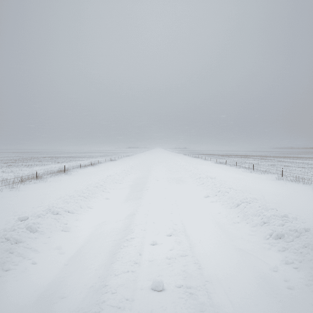
For many of the affected communities, the pattern is familiar. Spring breakup on the rivers that drain into James Bay, combined with a snowpack well above the long-term average, has turned a predictable seasonal risk into a fast-moving emergency. What makes 2026 different, local officials say, is the volume of water coming off the landscape and the thickness of the river ice, which is elevating the risk of sudden ice jams.
Kashechewan begins another spring evacuation
Kashechewan First Nation, a Cree community of about 2,300 on the west coast of James Bay, began evacuating vulnerable residents on April 17 as a precaution against flooding from the Albany River. Executive director Tyson Wesley told reporters that river ice measured this spring is thicker than in most recent years, a factor that sharply increases the risk of jamming when breakup occurs.
Most of the community's residents had already left the First Nation earlier in the year because of problems with the water treatment plant, which is not expected to be fully repaired until June. The current evacuation targets those who had remained in the community, including elders, children, and people with mobility or medical needs. Evacuees are being flown to Niagara Falls, Kingston, and Kapuskasing, where host cities have been sheltering Kashechewan members for weeks.
The First Nation's leadership has long argued that the community should be permanently relocated to higher ground, a recommendation echoed in a series of federal reports stretching back more than two decades. Chief Gaius Wesley has repeatedly pressed Ottawa to fund a move to a previously identified site, noting that the current cycle of evacuations and temporary fixes imposes both trauma and cost on residents. Indigenous Services Canada has confirmed it is working with the community, but no firm timeline for relocation has been announced.
States of emergency across Ontario
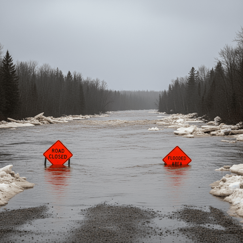
In central and northeastern Ontario, municipalities have declared states of emergency in response to rapidly rising water. The Township of Chisholm, near North Bay, declared an emergency after severe flooding overwhelmed roads and damaged private property. Minden Hills in Haliburton County followed with its own declaration as water levels on the Gull River surged past expected spring peaks.
On Manitoulin Island, the Township of Assiginack, the Township of Billings, the Municipality of Gordon/Barrie Island, and Tehkummah Township have all declared emergencies, with local officials citing blocked culverts, compromised roadways, and threats to drinking water supplies. Conservation authorities across the region have issued a cascade of flood warnings and flood watches.
Emergency Management Ontario has deployed personnel and sandbag supplies to the hardest-hit communities, and the Ontario Provincial Police have closed several regional roads. Local officials say the most acute risk in the coming days is a combination of warm daytime temperatures and additional rainfall, which together could accelerate snowmelt at a time when waterways are already at capacity.
The Ottawa River watch
Downstream, attention has shifted to the Ottawa River. The Ottawa River Regulation Planning Board, which oversees a network of reservoirs across the watershed, said earlier this week that water has reached minor flooding levels in Pembroke and that major flooding between Arnprior and Cumberland cannot be ruled out. City officials in Ottawa have begun pre-positioning sandbags in low-lying neighbourhoods and have warned homeowners in Britannia, Constance Bay, and Cumberland to prepare.
The watershed entered the spring with snowpack well above the long-term average in its northern reaches, a pattern that historically increases the risk of a late-season flood peak. Board officials say reservoir management can only absorb part of the runoff, and that downstream communities should plan for elevated water levels into late April and early May.
Farther west, Goulais River, Mississagi River, and Spanish River watersheds are all reporting water levels above normal for mid-April. Environment and Climate Change Canada is forecasting additional precipitation for much of northeastern Ontario over the coming days, including a mix of rain and wet snow at higher elevations.
The cost to families and businesses
For families in the affected communities, the toll is both practical and psychological. Evacuees from Kashechewan face weeks or months away from home, with children attending school in host cities and elders separated from familiar surroundings. In the flooded municipalities, homeowners are pumping basements, protecting furnaces, and bracing for insurance claims that often take months to resolve.
Small businesses on Manitoulin Island, where tourism is a critical spring and summer earner, face the prospect of disruption heading into a season that typically relies on dependable road access. Tourism operators say the flooding is occurring weeks before the usual peak season but is already causing cancellations and reservation uncertainty. Local chambers of commerce have urged the province to ensure any provincial disaster financial assistance is rolled out quickly if damage is significant.
Municipal budgets are also taking a hit. Smaller communities, which typically carry limited reserves for emergency response, face bills for equipment rentals, overtime, and post-event recovery that can exhaust annual contingencies. Ontario's Municipal Disaster Recovery Assistance program covers a portion of eligible costs after declarations, but officials say the paperwork and reimbursement cycle is lengthy.
Climate change and changing flood patterns
Scientists who study Canadian watersheds say the 2026 spring is consistent with a broader pattern of more volatile snowmelt and precipitation events in a warming climate. Warmer winters can paradoxically leave thicker river ice in place while heavier late-winter snowfall loads the landscape with water that melts in a compressed window. The combination produces faster peaks and more frequent ice jams.
Research from the University of Waterloo's Intact Centre on Climate Adaptation, published earlier this year, estimated that basement flood damage in Canada had risen sharply over the past two decades, with costs concentrated in areas where stormwater infrastructure has not kept pace with more intense rainfall. The federal government's National Adaptation Strategy, updated last year, highlighted freshwater flooding as one of the country's most significant climate-related risks.
Indigenous leaders in the James Bay lowlands argue that climate change is compounding long-standing infrastructure deficits in their communities. Water treatment plants built on floodplains, undersized culverts, and aging dikes all perform worse under the conditions now becoming common. Federal officials have said future spending plans will address some of these gaps, but progress on the ground has been slow.
Volunteer and community response
Across the affected region, volunteer response networks have mobilised quickly. Church groups, service clubs, and local emergency response teams are running sandbag operations, opening warming centres, and delivering supplies to residents cut off by flooded roads. The Canadian Red Cross has activated registration and emergency lodging operations in several host communities, and local municipalities have set up donation channels for flood-affected households.
Community members in Haliburton County and on Manitoulin Island have reported significant neighbour-to-neighbour assistance, from pumping basements to moving livestock out of flooded fields. Farmers in the Mississagi and Spanish River corridors have opened higher-ground pastures to neighbours displaced by rising water. The volunteer effort has been a point of local pride, but also underscores how much of the response to extreme weather in rural Ontario still depends on informal networks rather than dedicated emergency services.
In Kashechewan, community members have organised packing and travel logistics for the evacuation, while Elders have taken part in briefings with host community officials to ensure cultural needs are respected during extended stays away from home. The role of Indigenous-led organisations in the response has been significant, though community leaders say sustained federal investment in local capacity would reduce the burden on volunteers during each year's emergency.
Provincial and federal responses
Ontario Premier Doug Ford has said the province stands ready to deploy additional resources as needed and has confirmed that Emergency Management Ontario is coordinating with affected municipalities and First Nations. Provincial officials say they have requested federal assistance from Ottawa where required, including logistical support for the Kashechewan evacuation.
Prime Minister Mark Carney's office has said the federal government is monitoring the situation closely and that Indigenous Services Canada, Public Safety Canada, and the Canadian Armed Forces are on standby to provide additional support if local capacity is exceeded. The Canadian Red Cross is registering evacuees and managing host-city arrangements under a longstanding agreement with Indigenous Services Canada.
Local MPs and MPPs have joined calls for longer-term investment in flood resilience, including the permanent relocation of communities at repeated risk. In previous years, federal and provincial governments have committed to studies and partial funding, but advocates say political attention typically fades once the waters recede.
What's next
Environment Canada meteorologists say the next seventy-two hours will be critical. Additional rainfall, combined with continuing snowmelt, could push rivers across the affected regions past major flood thresholds. If temperatures spike as forecast, the risk of ice jam flooding will rise further, particularly in the James Bay lowlands and on smaller rivers feeding into the Ottawa system.
For Kashechewan, the immediate priority is the safe evacuation of remaining residents and the protection of the community's infrastructure. Beyond that, the community is preparing a renewed push for permanent relocation funding, arguing that continuing to rebuild in the same flood-prone location is neither safe nor economically sensible. For the rest of the affected region, local officials will be watching forecasts closely and asking Canadians to respect road closures, avoid flooded areas, and follow instructions from emergency services.
The story this spring is a familiar one for communities that sit in the path of rising rivers. What is becoming harder to ignore is how often it is being told, and how loudly those on the front lines are asking for long-term answers to what has become a near-annual emergency.