Spring Blizzard and Flood Risk: The Prairies Brace for a Brutal Week
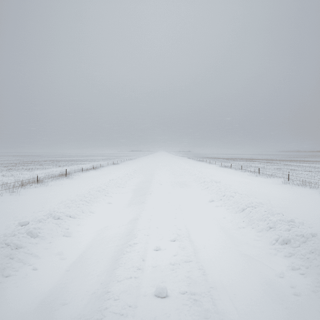
The Prairie provinces entered the third week of April 2026 bracing for weather that would test the endurance of farmers, municipalities, and emergency managers across the region. Two successive weather systems have brought significant snowfall and strong winds to Alberta, Saskatchewan, and Manitoba, with accumulations of 10 to 20 centimetres or more recorded in several areas and additional snowfall possible before temperatures moderate. At the same time, Manitoba's Hydrologic Forecast Centre has elevated flood risk warnings for the Interlake region and Parkland areas, setting up the possibility of a difficult spring melt season to follow the snow.
The Weather Systems: What Is Moving Through
The first of the two systems arrived in southern Alberta early in the week, bringing heavy, wet snow to areas from Calgary south to Lethbridge and Medicine Hat. That system tracked northeast through Saskatchewan, delivering substantial accumulations across the central prairies before reaching Manitoba by midweek. A second, more powerful low-pressure system followed close behind, intensifying as it drew moisture from the Gulf of Mexico and cold Arctic air from the northwest in the pattern that produces the Prairie blizzards well-known to anyone who has spent a spring in the region.
Wind gusts with the second system exceeded 80 kilometres per hour in open areas of Saskatchewan and Manitoba, reducing visibility to near zero in blowing and drifting snow. Environment and Climate Change Canada issued blizzard warnings and winter storm warnings for large portions of all three provinces, affecting areas from the Alberta foothills east to the Manitoba-Ontario border. The combination of significant snowfall and high winds is particularly treacherous in open Prairie terrain where there are few natural windbreaks and drifting can close roads within hours of plowing.
The temperature pattern has added complexity to the weather event. Daytime temperatures have hovered near the freezing point in many areas, producing heavy, wet snow that accumulates rapidly, stresses structures, and is particularly damaging to spring crops and early vegetation. The wet snow also saturates soil and low-lying areas, contributing to the flood risk that is emerging as a parallel concern to the storm itself.
Meteorologists tracking the systems have noted that late-April snowfall events of this magnitude are not unprecedented on the Prairies but are at the more significant end of the historical range. Climate scientists have pointed to increased variability in Prairie spring weather patterns as a feature of the changing climate, with late-season extreme events becoming more common even as the overall trend toward warmer springs continues. This week's systems are a reminder that the window between winter and planting season on the Prairies remains narrow and precarious.
Which Regions Are Hardest Hit
In Alberta, the hardest-hit areas have been the central and southern portions of the province. The Calgary region saw 15 to 18 centimetres of wet snow in the first system, causing significant road closures on secondary highways and major disruptions on the Trans-Canada and other primary routes. The snowfall also knocked out power to thousands of customers in Calgary and surrounding communities as the weight of wet snow brought down branches and lines.
Central Saskatchewan, including the areas around Saskatoon, North Battleford, and Prince Albert, received 10 to 15 centimetres in the combined systems, with drifting creating additional hazards on rural roads. The Saskatchewan government activated its emergency coordination centre early in the week and worked with municipalities and the province's highway department to maintain access on priority routes. Several smaller communities experienced periods of isolation as secondary roads drifted shut.
Manitoba has seen the heaviest overall impacts from the combined weather and flood risk picture. The Red River Valley, Interlake, and Parkland regions have all experienced significant snowfall on top of soils already saturated from earlier spring melting. Brandon and the Westman region received more than 20 centimetres in the second system, with winds creating drifts well above that depth in open areas. Winnipeg saw somewhat less snow but experienced extended periods of reduced visibility and difficult driving conditions.
Northern areas of all three provinces have been less affected by the southern systems but face their own spring challenges as snowpack from a heavy winter begins to melt. Drainage systems in northern Saskatchewan and Manitoba are under stress, and communities in low-lying areas have been advised to monitor water levels and have contingency plans ready for rapid changes in conditions over the coming weeks.
Agricultural Impacts: Seeding Delays and Livestock Concerns
For Prairie farmers, the timing of this weather event could not be more challenging. April is the month when soil preparation and early seeding begin for many crop types, and significant late snowfall directly delays that work. Every week of delay in seeding canola, wheat, and other major Prairie crops shortens the growing season and increases the risk that crops will not reach maturity before fall frost.
Agrologists in Alberta and Saskatchewan estimate that the back-to-back storm systems have pushed seeding timelines back by one to two weeks in affected regions. On their own, those delays are manageable; Prairie farmers deal with weather variability every year and have adapted their operations accordingly. The concern is whether conditions will allow a rapid catch-up once the snow melts, or whether continued wet soil conditions will extend the delay further into May.
Soil moisture levels are already high across much of the southern Prairies following a wetter-than-normal winter. Additional snowfall that melts into already saturated soil simply runs off into low-lying areas or remains on the surface as standing water. Fields that cannot be entered with seeding equipment due to wet conditions are lost days in the planting calendar that farmers cannot recover. Crop insurance programs in all three provinces provide some protection against yield losses caused by late planting, but they cannot compensate for the stress and uncertainty that delayed seasons create.
Livestock producers face different but equally immediate concerns. Late-season snowfall means pregnant cattle and other livestock that producers had begun transitioning to spring pastures must be brought back in or sheltered through the storm period. The logistical demands of managing that transition in difficult conditions, with roads compromised and feed supplies that were calculated for an earlier end to winter, are considerable. Cattle producers in southern Alberta and Saskatchewan have reported scrambling to ensure animals are protected through the worst of the weather.
Manitoba Flood Risk: The Interlake and Parkland Warnings
The flood risk picture in Manitoba deserves particular attention given the province's history with spring flooding. Manitoba's Hydrologic Forecast Centre elevated its warnings for the Interlake region and Parkland areas this week, citing the combination of high existing soil moisture, significant snowpack still present in northern drainage areas, and the additional moisture being added by the current storm systems.
The Interlake region, the area between Lake Winnipeg and Lake Manitoba north of Winnipeg, is chronically vulnerable to spring flooding due to its flat topography, clay soils that drain poorly, and dependence on the slow movement of water through a network of drains and ditches that can be quickly overwhelmed. Several communities in the Interlake have been flooded repeatedly in past decades, and the province has invested in flood control infrastructure, but the system's capacity has limits that can be exceeded in severe spring conditions.
The Parkland region in western Manitoba, encompassing areas around Dauphin, Swan River, and the areas draining toward Lake Winnipegosis and Lake Manitoba, faces flood risk from a combination of local snowmelt and elevated water levels in the lake system. The Assiniboine River watershed, which drains much of southwestern Manitoba and portions of Saskatchewan, is also being monitored given the snowpack in its upper reaches.
The province's Emergency Measures Organization has been in contact with municipalities in elevated-risk areas, encouraging communities to review their flood response plans and ensure that sandbag supplies and pumping equipment are positioned appropriately. The province has pre-positioned materials in key locations based on the Hydrologic Forecast Centre's models. The coming two to three weeks, as temperatures rise and snowmelt accelerates, will determine whether the warnings translate into actual flood events or whether drainage can keep pace with the melt.
Lessons from Previous Springs
Manitoba has weathered significant spring floods in the past, most notably in 2009 and 2011 when record Red River flows threatened Winnipeg and inundated large areas of rural Manitoba. Those events led to major investments in flood protection infrastructure, including the expansion of the Red River Floodway and upgrades to control structures at Lake Manitoba and Lake St. Martin. The experience also sharpened the province's emergency management capabilities and the community-level preparedness that is essential when flooding threatens.
The 2011 flood, in particular, left a lasting mark on Manitoba communities. Forced evacuations of First Nations and rural communities, the displacement of thousands of residents for months, and the slow process of recovery and reconstruction demonstrated both the resilience of Prairie communities and the limits of infrastructure and emergency response systems. Provincial and federal investment in the years following 2011 has improved the situation, but no flood protection system can prevent all damage in extreme conditions.
Saskatchewan and Alberta have their own histories with spring flooding, particularly in river valleys and low-lying agricultural areas. The 2013 floods in southern Alberta, which caused billions of dollars in damage to Calgary and surrounding communities, remain a reference point for the kind of rapid-onset flooding that can occur when snowmelt combines with rainfall on saturated soils. That event prompted major investment in flood mitigation infrastructure in the Bow River and Elbow River systems.
Emergency managers across the Prairies have developed sophisticated modelling and warning systems in the years since those major events. The ability to forecast flood risk days and weeks in advance, rather than reacting as events unfold, is substantially better than it was a decade ago. The current warnings for Manitoba's Interlake and Parkland are an example of that improved early warning capacity in action.
Emergency Preparedness: What Residents Should Do
For residents in areas under weather or flood warnings across the Prairies, the immediate priorities are familiar: check on vulnerable neighbours, ensure emergency kits are stocked and accessible, and stay informed through official channels rather than social media rumours. Emergency kits should include food and water for at least 72 hours, medications, important documents in waterproof containers, a battery-powered radio, and warm clothing and blankets appropriate for Prairie temperatures.
Drivers should avoid travel in blizzard conditions unless absolutely necessary. When travel is unavoidable, vehicles should carry emergency supplies including a shovel, traction aids, extra warm clothing, food, water, and a fully charged phone. Letting someone know the intended route and estimated arrival time before setting out is basic but frequently overlooked emergency practice that has saved lives on Prairie roads.
Residents in flood-prone areas should monitor water levels near their properties and the official updates from Manitoba's Hydrologic Forecast Centre and provincial emergency management authorities. Those in areas with a history of flooding should consider moving important belongings, documents, and valuables to higher floors or locations and should know in advance how to reach the nearest emergency shelter if evacuation becomes necessary.
Farmers dealing with the immediate storm should prioritise livestock welfare and equipment protection, delaying field work until conditions are safe and soils have dried to a workable state. Attempting to enter wet fields with heavy equipment causes soil compaction damage that affects crop yields for years afterward, making patience in the short term the strategically correct choice even when the urge to catch up on delayed planting work is strong.
The Weeks Ahead
Environment Canada's extended outlook for the Prairies suggests temperatures will moderate through the final week of April, accelerating the snowmelt that will be the defining weather story for the region in early May. The pace of that melt, and whether it is accompanied by significant rainfall, will determine the severity of the flood season across the region.
Agricultural recovery will also be closely watched. If soils can dry sufficiently by early May to allow seeding to begin, the crop season can proceed with limited overall impact from the April storms. A late and wet spring that extends delays into mid-May would be more concerning, shifting risk calculations for canola and other crops that require a full growing season. Prairie farmers are nothing if not adaptable, but adaptation has limits when the calendar is unforgiving.
For now, the task is getting through the immediate storm period safely, protecting property and livestock, and maintaining the infrastructure of roads, bridges, and drainage systems that Prairie communities depend on year-round. The Prairies have seen difficult springs before, and they have come through them. The communities bracing for this week's conditions have the resilience and the experience to manage what is coming. The challenge, as always, is the uncertainty of what exactly the spring of 2026 will ultimately deliver.
Related Stories

Yukon launches heating rebates after -50 C cold snap strained the grid
13h ago

Gjoa Haven lifts emergency after power failure, four-month water crisis
13h ago
Prairie wildfire threat builds as warm spring follows dry winter
13h ago

B.C. braces for tough 2026 wildfire season as northeast drought deepens
13h ago